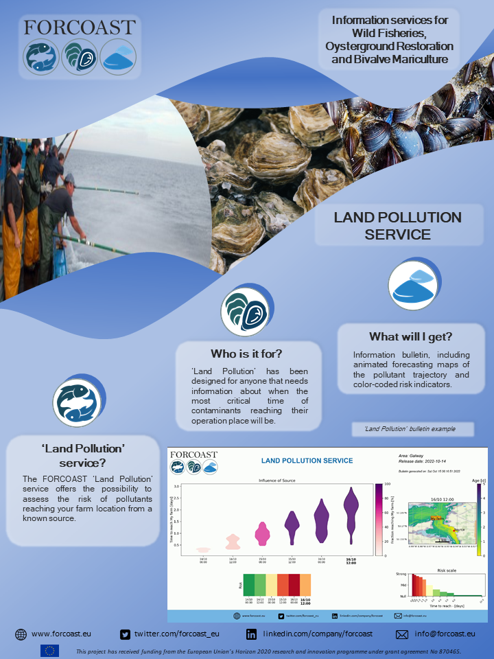
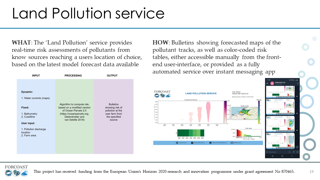
Nearshore farming infrastructures are exposed to land discharges, which in some cases carry harmful substances (e.g. E. coli, pollutants). High-resolution circulation forecasts can be used to assess the likelihood of a farm being affected by material released from potentially harmful sources. This service aims to support quality control, by providing a measure of the probability for farming sites to be affected by harmful land discharge.
This service is currently available in the Eforie area in Bulgaria, the Northern-Adiratic Sea and the Galway bay. By selecting a pollution source and a rectangle in which the farm is located, the pollution risk of the farm can be forecasted. The bulletin that is generated will provide the user with an animated map of the spread of the pollutants over time and a risk graph and risk indicator, providing information on the risk of the farm being affected by the released pollutants. The data used for this service module are provided by seamod.ro, Marine Institute and the National Institute of Oceanography and Applied Geophysics (OGS).