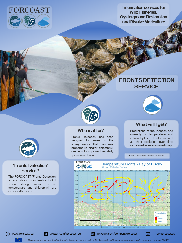
Frontal areas are those where there is a sharp gradient in certain properties of seawater, such as temperature or chlorophyll-a concentration. These areas are characterized by a higher-than-normal biological activity, and therefore can be used as an indicator of the presence of certain commercial fish species, helping the user identify potential fishing grounds.
Sea fronts can be identified using both remote sensing imagery (real-time) and model data (forecast of fronts’ positions and intensities). The fishing sector needs easy to understand and highly processed data to make fast decisions on where to go for optimizing routes, in combination with the user knowledge and experience. This service module has been designed with both qualities in mind, which allows identifying the areas of interest immediately, with the subsequent reduction in the time spent at sea and fueling usage.
The service is currently available for the Bay of Biscay and the Northern-Adriatic Sea. The service will produce a map with an indication of where strong-, weak- or no fronts will be present. The types of fronts that can be forecasted are the temperature and chlorophyll fronts. The services can produce forecasts based on hourly mean for both temperature and chlorophyll in the Northern-Adriatic Sea and temperature in the Bay of Biscay. The service will produce forecasts based on daily mean for chlorophyll in the Bay of Biscay. The data used for this service is retrieved from the National Institute of Oceanography and Applied Geophysics (OGS), Basque Operational Oceanography System (euskOOS) and CMEMS.


🇪🇸 🇮🇹