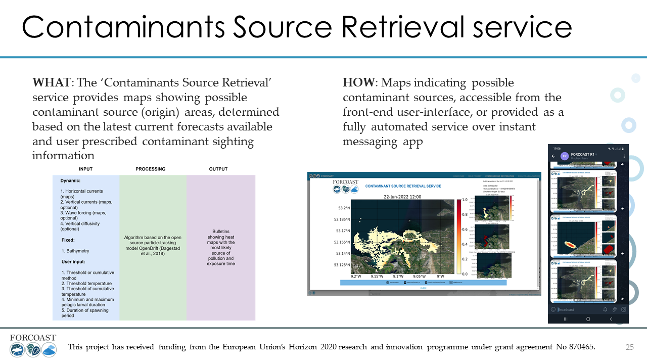
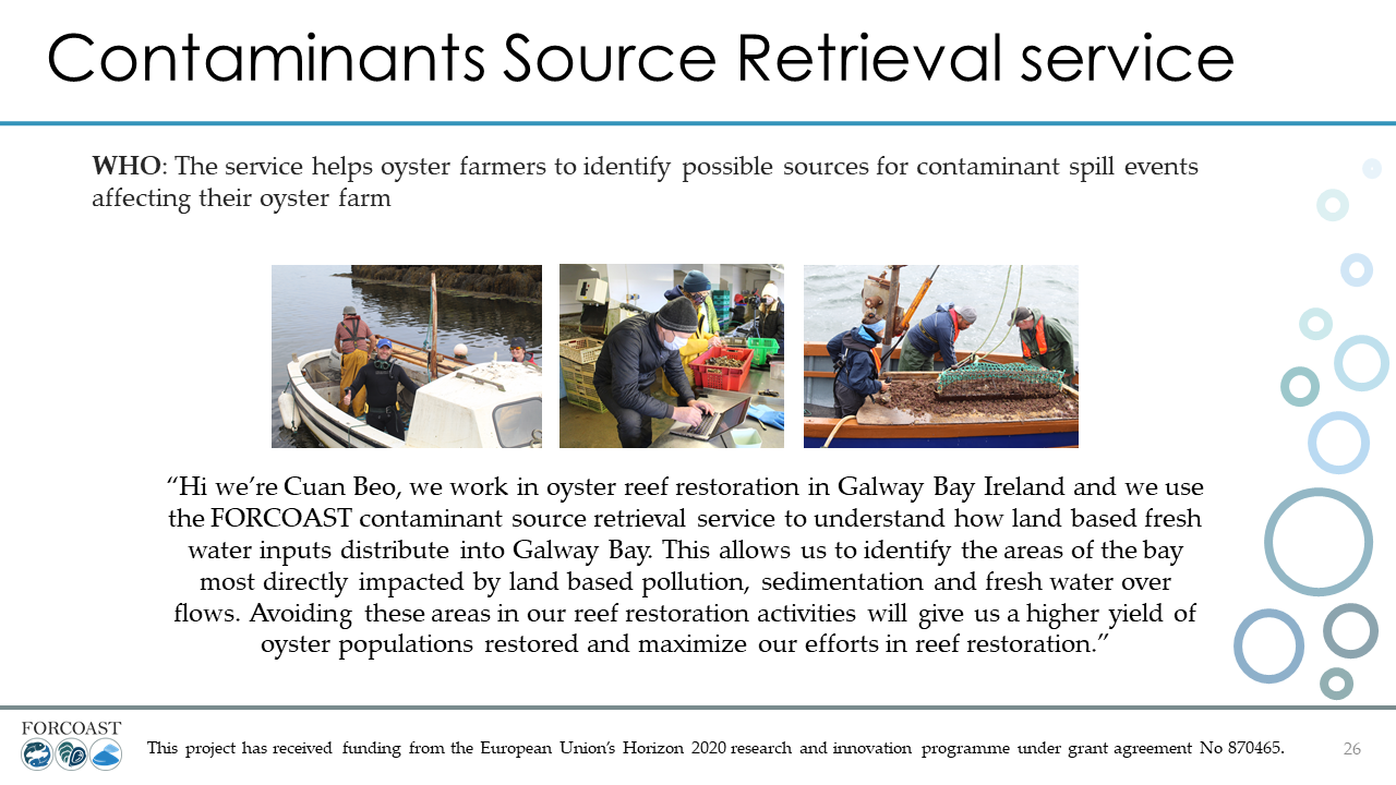
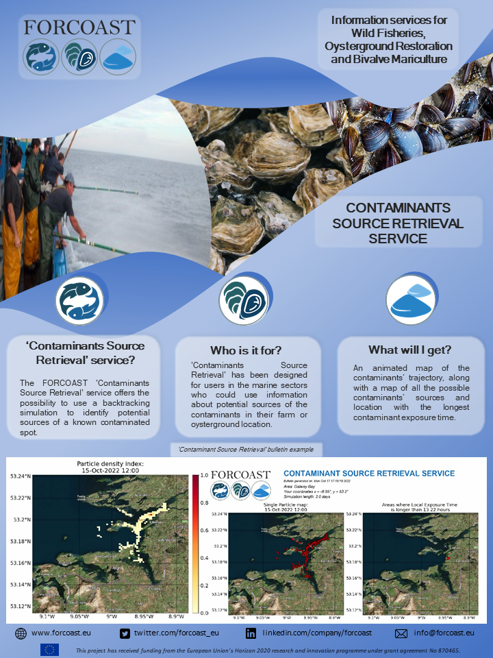
Contaminants can affect a farming or oysterground location negatively. Therefore, it can be useful to find the source location of the identified contaminants. This service provides a way to backtrack the contaminant to it’s potential and most likely source locations. To run this service, a location where the contaminants are present, the duration of the backtracking simulation, and the starting time must be given.
The service is currently available for the Southern-North Sea and the Galway bay. The service output is a bulletin with an animated map following the likely path of the contaminants for the source to its target location. Additional maps are shown visualizing all possible source locations and the locations with the highest contaminant exposure time. The data used for this service are provided by Marine Institute and the Royal Belgian Institute of Natural Sciences (RBINS).

Contaminants Source Retrieval
🇮🇪 🇧🇪