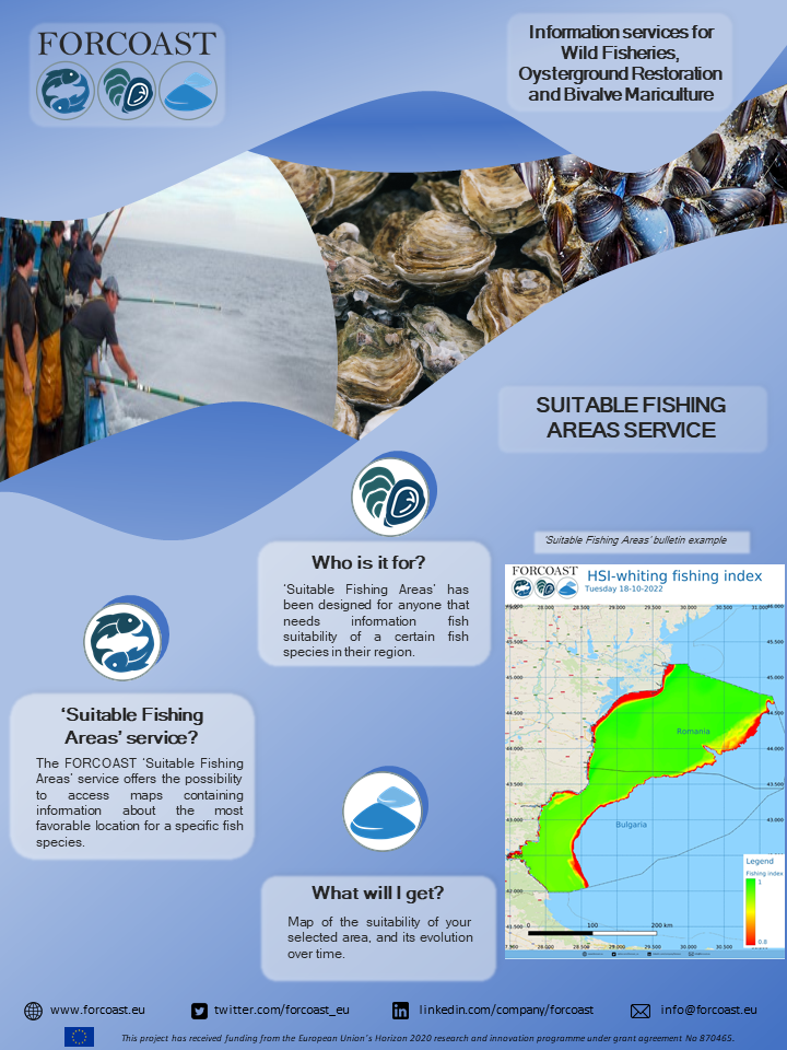
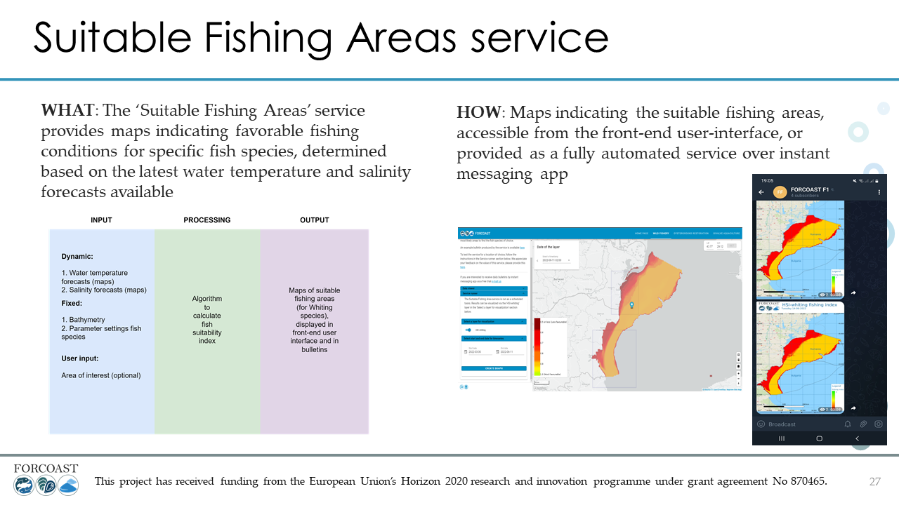
The presence of areas with high concentrations of fish resources is highly influenced by seasonal variations. In addition, spatial distribution of zones with high fish resources could represent an issue – large distances between fishing areas and collecting centers. The aim of the Fishing Suitability Index developed within this service module is to address these specific stakeholder needs by offering information regarding the localization of optimal conditions for fishing activities in the area of interest.
The service is currently operational in the Western-Black Sea and provides a forecast map with an index for Fish Suitability for Whiting fish. The index has values ranging from 0.1 (less suitable) and 1.0 (best condition). The index is based on values of temperature, salinity, and bathymetry in the area. The data is being provided by CMEMS.